A hazard to one cyclist is normal riding to another. To get to the beautiful places we take you, expect plenty of potholes and loose gravel, grass growing in the middle of the lane. Some ascents will be very steep and some descents also, with a few sharp blind bends which may hide an approaching vehicle.
The Highland Challenge remains an un-marshalled ride with no warning signs before potential hazards: you are responsible for your own safety. But we do inspect the route carefully and complete the following Risk Assessment, which we ask entrants to read, either using this link or reading its text below:
https://1drv.ms/w/c/0dff9d58c1dd0404/IQC2pbTeu7D3S5ZG4pohPfdOAWNFg-qU7rnXu9pnEEFReLI
Risk assessment
Organisation name:Ludlow Cycling Club
Assessment carried out by: Charles Edwards
Date of assessment: June 4th 2026 Date of next review: May 2027
For: Ludlow Cycling Club’s Danny Mason Highland Challenge, an annual non-competitive sportive/audax type ride, going since 1991, through and sometimes a little beyond the Shropshire Hills. Its aim is to get riders to appreciate the beauty of the Shropshire Hills and to foster positive attitudes to cycling outdoors, and to cycling as an effective and social form of exercise. The event raises funds for Shropshire Wildlife Trust. A new route, typically between 64 and 69 miles, is used each year. There are 3 feedstops en-route and the ride starts and ends at an HQ at Ludlow Rugby Club
Route: 68 miles from and back to Ludlow Rugby Club via feedstops at Chapel Lawn, Kerry and Mainstone. The route is signed at every turn/junction the day before the ride and each rider is sent the route link electronically to download onto any devices they may use on the ride.
Organisers: Charles and Gwyneth Edwards organise the event on behalf of Ludlow Cycling Club. It is their responsibility to ensure that all the actions in this Assessment are carried out by the date of the ride.
| What are the hazards? | Who might be harmed and how? | What are you already doing to control the risks? | What further action do you need to take to control the risks? |
|
| 1. As the riders are unled over 68 hilly miles, often on narrow lanes, poor surfaces, steep ascents & descents and blind bends, there’s a moderate risk of rider accident. Some inexperienced or young/elderly riders may be more accident-prone and a danger to themselves, other riders and other road users. Because riders are responsible for ensuring their own bikes are suitable for the ride, there’s a risk of unsuitable or even dangerous bikes. |
Riders, other riders and other road users | Very clear spelling out of the nature of the event, road conditions, organiser contact info, and requirements of riders and their bikes on a mixture of:
· Pre-signing up info · Event website · Final joining instructions Have track pump & spare tubes & tyres each feedstop |
Post this risk assessment up on the event website, and signpost riders to it in the final joining email to all of them. This action itself serves as a notification to riders of the range of hazards to expect
Explain a ABCD bike check on the event website |
|
| 2. Not knowing who the riders are, whether they need parental consent*, who their In Case of Emergency contacts are, what special issues they may have | Riders and their families & friends | Pre-ride register of name, phone no. and ICE details – each rider | ||
| 3. Not having 1st aid equipment to deal with minor injuries en-route | Rider | Ensure in-date 1st Aid kit kept at each feedstop | ||
| 4. Riders coming inadequately supplied or dressed | Rider, and potentially other riders | Spell out in final joining instructions which are emailed to each rider | ||
| 5. Risk of bad/dangerous weather on the day | Riders, other riders & other road users | Brief riders when they sign on. If seriously dangerous, cancel the event | ||
| 6. Riders getting lost | Riders | The route is checked the day before the ride and each rider is sent the route link electronically in advance to download onto any devices they may use on the ride. | Route fully signed (every turn and junction) in 2026 | |
| 7. 0.1 miles in, right turn across light traffic | Rider, other riders & other road users | Warning signs (to approaching vehicles) put up ca. 100 metres either side of turn Marshall at junction |
||
| 8. 0.2 miles in, right turn across light traffic | Ditto | Warning signs at ca. 100 metres either side of turn Marshall at junction |
||
| 9. 0.5 miles in, right turn across light traffic | Ditto | Warning signs at ca. 100 metres either side of turn | ||
| 10. 4.6 miles in, right turn across traffic, onto first poor surface lane | Ditto | Warning signs at ca. 100 metres either side of turn. Poor surface in general warning (see 1 above) | ||
| 11. 7.8 miles in, unclear road marking | Ditto | Directional signage | ||
| 12. 8.5 miles in, right turn across traffic | Ditto | Warning signs at ca. 100 metres either side of turn | ||
| 13. 10.1 miles in, crossing A road | Ditto | Warning signs at ca. 100 metres either side of crossing | ||
| 14. From 10.1 miles in, the 1st of many poor road surfaces | Ditto | Generic warning to expect poor road surfaces | ||
| 15. 11.5 miles in, an easy to miss right turn | Riders | General signage & route-finding responsibility comms | Extra prominent road signage | |
| 16. 12.5 miles in, right turn across traffic with limited visibility | Rider, other riders & other road users | Warning signs at ca. 100 metres either side of turn
Warning sign for cyclists at turn |
||
| 17. Riders cross rail tracks at level crossing, risk of trapping wheel in tracks | Rider, other riders | Publishing and signposting this Risk Assessment to riders | ||
| 18. At 16.5 miles in, right turn across traffic to Feedstop, and again exiting from Feedstop | Rider, other riders & other road users | Warning signs at ca. 100 metres either side of turn | ||
| 19. At 17.8 miles in, a staggered crossing of an A road | Ditto | Warning signs at ca. 100 metres either side of crossing | ||
| 20. From left turn at 18.9 miles in to the crossroads at 22.4 miles in, a particularly poor stretch of road surface | Rider, other riders & other road users | Generic warning to expect poor road surfaces | Publishing and signposting this Risk Assessment to riders | |
| 21. At 27.3 miles in, an easily missable Give Way when proceeding straight over at a crossroads | Ditto | Warning signs at ca. 100 metres either side of crossing
Warning sign for cyclists at crossroads |
||
| 22. At 34.7 miles in, an easily missable left turn to Kerry | Riders | General signage & route-finding responsibility comms | Extra prominent road signage | |
| 23. At 36.5 miles in, just after exiting lunch Feedstop, a right turn across A road traffic | Rider, other riders & other road users | Warning signs at ca. 100 metres either side of turn | ||
| 24. At 40.2 miles in, a right turn across A road traffic | Ditto | Warning signs at ca. 100 metres either side of turn | ||
| 25. From 40.2 to 42 miles in, the climb is steep, narrow, on a poor surface and with limited visibility | Ditto | Generic warning to expect poor road surfaces | Publishing and signposting this Risk Assessment to riders | |
| 26. At 44.7 miles in, right turn across traffic | Ditto | Generic rider caution warnings | None: roads too minor and visibility too good to warrant warning signs to vehicles | |
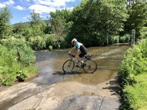
| 27. At 45.3 miles in, particularly poor surface crossing River Unk | Rider, other riders | Generic warning to expect poor road surfaces | Publishing and signposting this Risk Assessment to riders | |
| 28. At 45.8 miles in, right turn across traffic | Rider, other riders & other road users | Generic rider caution warnings | None: roads too minor and visibility too good to warrant warning signs to vehicles | |
| 29. At 46.8, right turn across traffic to 3rd Feedstop, and again on exiting Feedstop | Ditto | Generic rider caution warnings | None: roads too minor and visibility too good to warrant warning signs to vehicles | |
| 30. At 47.2 miles in, right turn across traffic | Rider, other riders & other road users | Generic rider caution warnings | None: roads too minor and visibility too good to warrant warning signs to vehicles | |
| 31. At 47.3 miles in, steep, gravelly surfaced climb just after crossing River Unk again | Rider, other riders | Generic warning to expect poor road surfaces | Publishing and signposting this Risk Assessment to riders | |
| 32. At 50.2 miles in, right turn at T-junction across traffic | Rider, other riders & other road users | Generic rider caution warnings | None: roads too minor and visibility too good to warrant warning signs to vehicles | |
| 33. At 51 miles in, right turn across traffic at T-junct with A488 | Ditto | Warning signs at ca. 100 metres either side of turn | ||
| 34. At 51.8 miles in, in Clun, parked cars on B4368 road to negotiate | Ditto | Generic rider caution warnings | Publishing and signposting this Risk Assessment to riders | |
| 35. At 55.5 miles in, right turn across B4368 traffic | Ditto | Warning signs at ca. 100 metres either side of turn | ||
| 36. From 57 to 58.4 miles in, particularly poor road surface | Riders, other riders | Generic warning to expect poor road surfaces | Publishing and signposting this Risk Assessment to riders | |
| 37. At 58.9 miles in, right turn across B4367 traffic | Rider, other riders & other road users | Warning signs at ca. 100 metres either side of turn | ||
| 38. At 59.6 miles in, right at T across traffic then left on poor surface | Ditto | Generic rider caution warnings | None: roads too minor and visibility too good to warrant warning signs to vehicles | |
| 39. At 63.1 miles in, left onto busy A49, over level crossing then right across traffic at temporary traffic lights | Ditto | Double warning signs at ca. 100 metres either side of turns | ||
| 40. At 65.6 miles in, across road at Give Way | Ditto | Warning signs at ca.100 metres either side of crossroads | ||
| 41. At 66.1 miles in, riders have to negotiate gate on bridleway | Rider, other riders | Generic rider caution warnings | ||
| 42. At 66.2 miles in, right rurn onto B4365 | Rider, other riders & other road users | Warning signs at ca. 100 metres either side of turn | ||
| 43.At 66.3 miles in, turn left onto busy A49 | Ditto | Warning signs at ca. 100 metres north side of turn | ||
| 44. At 67.9 miles in, right turn across traffic, limited visibility | Ditto | Warning signs at ca. 100 metres either side of turn | ||
| 45. At 68.4 miles, right turn into Rugby Club | Ditto | Warning signs at ca.100 metres either side of turn | ||
* Parental Consent forms are needed for all riders aged 17 or under. Those between 13 and 17 inclusive may ride unaccompanied if they have a signed Parental Consent form. Riders under the age of 13 can ride only if accompanied by parent/guardian or a rider authorised to act in loco parentis but they still need the Parental Consent form signed